
TIGER/Line Shapefile, 2022, County, Volusia County, FL, Address Range-Feature
The TIGER/Line shapefiles and related database files (.dbf) are an extract of selected geographic and cartographic information from the U.S. Census Bureau's Master Address File / Topologically Integrated Geographic Encoding and Referencing (MAF/TIGER) Database (MTDB). The MTDB represents a seamless national file with no overlaps or gaps between parts, however, each TIGER/Line shapefile is designed to stand alone as an independent data set, or they can be combined to cover the entire nation.
The Address Ranges Feature Shapefile (ADDRFEAT.dbf) contains the geospatial edge geometry and attributes of all unsuppressed address ranges for a county or county equivalent area. The term "address range" refers to the collection of all possible structure numbers from the first structure number to the last structure number and all numbers of a specified parity in between along an edge side relative to the direction in which the edge is coded. Single-address address ranges have been suppressed to maintain the confidentiality of the addresses they describe.  Multiple coincident address range feature edge records are represented in the shapefile if more than one left or right address ranges are associated to the edge. The ADDRFEAT shapefile contains a record for each address range to street name combination. Address range associated to more than one street name are also represented by multiple coincident address range feature edge records. Note that the ADDRFEAT shapefile includes all unsuppressed address ranges compared to the All Lines Shapefile (EDGES.shp) which only includes the most inclusive address range associated with each side of a street edge.  The TIGER/Line shapefile contain potential address ranges, not individual addresses.  The address ranges in the TIGER/Line Files are potential ranges that include the full range of possible structure numbers even though the actual structures may not exist.
Completed
GeoPlatform Metadata Information
Categories
Update Frequency
- Completed
GeoPlatform Identifier
- 68890880-61b1-49f2-b455-32ed5d4f301e
F A I R
Valid Geospatial Data Links
Invalid Geospatial Data Links
- https://www2.census.gov/geo/tiger/TIGER2022/ADDRFEAT/tl_2022_12127_addrfeat.zip: Unable to check the direct link, it appears the Range header is not enabled on the server or reading the end-of-central-directory (EOCD) has failed.
- https://meta.geo.census.gov/data/existing/decennial/GEO/GPMB/TIGERline/Archived_19110/tl_2022_addrfeat.shp.ea.iso.xml: Invalid endpoint for geospatial data download.
F A I R
Download URLs
- https://www2.census.gov/geo/tiger/TIGER2022/ADDRFEAT/tl_2022_12127_addrfeat.zip
- https://meta.geo.census.gov/data/existing/decennial/GEO/GPMB/TIGERline/Archived_19110/tl_2022_addrfeat.shp.ea.iso.xml
Contact URLs
- https://spatialreference.org/ref/epsg/4269/gml/
Anchor Links
-
No Anchor Links Found
F A I R
Error: no image
F A I R
- U.S. Department of Commerce, U.S. Census Bureau, Geography Division, Spatial Data Collection and Products Branch
F A I R
F A I R
F A I R
asNeeded or notPlanned with a completed status
F A I R
The TIGER/Line shapefiles and related database files (.dbf) are an extract of selected geographic and cartographic information from the U.S. Census Bureau's Master Address File / Topologically Integrated Geographic Encoding and Referencing (MAF/TIGER) Database (MTDB). The MTDB represents a seamless national file with no overlaps or gaps between parts, however, each TIGER/Line shapefile is designed to stand alone as an independent data set, or they can be combined to cover the entire nation.
The Address Ranges Feature Shapefile (ADDRFEAT.dbf) contains the geospatial edge geometry and attributes of all unsuppressed address ranges for a county or county equivalent area. The term "address range" refers to the collection of all possible structure numbers from the first structure number to the last structure number and all numbers of a specified parity in between along an edge side relative to the direction in which the edge is coded. Single-address address ranges have been suppressed to maintain the confidentiality of the addresses they describe. Multiple coincident address range feature edge records are represented in the shapefile if more than one left or right address ranges are associated to the edge. The ADDRFEAT shapefile contains a record for each address range to street name combination. Address range associated to more than one street name are also represented by multiple coincident address range feature edge records. Note that the ADDRFEAT shapefile includes all unsuppressed address ranges compared to the All Lines Shapefile (EDGES.shp) which only includes the most inclusive address range associated with each side of a street edge. The TIGER/Line shapefile contain potential address ranges, not individual addresses. The address ranges in the TIGER/Line Files are potential ranges that include the full range of possible structure numbers even though the actual structures may not exist.
F A I R
- U.S. Department of Commerce, U.S. Census Bureau, Geography Division, Spatial Data Collection and Products Branch
F A I R
dataset harvested from data.gov
F A I R
dataset meets GeoPlatform data requirements
F A I R
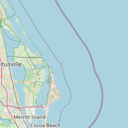
Spatial Extent: [-81.680903,28.612662,-80.663461,29.432462]
Extent US % Coverage: 0.06
Temporal Extent Begin: 2021-06
Temporal Extent End: 2022-08
F A I R
TIGER/Line Shapefile, 2022, County, Volusia County, FL, Address Range-Feature
F A I R
Checked 4 Code List Vocabularies.
Metadata Insights
View registry insightsMetadata Original Source
View metadata sourceSpatial Extent
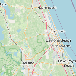
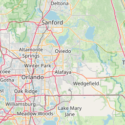
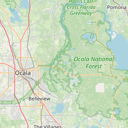
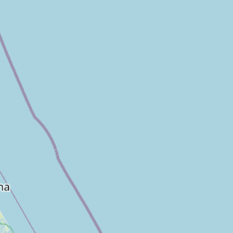


Leaflet © OpenStreetMap contributors
| North Bound Latitude | South Bound Latitude | East Bound Longitude | West Bound Longitude |
|---|---|---|---|
| 29.432462 | 28.612662 | -80.663461 | -81.680903 |